How to Access the Draft Feasibility Report and Submit Comments
The USACE released the Draft Feasibility Report for public comment on May 22, 2026. The report summarizes the economic, engineering and environmental analysis that led to Alternative 2 being recommended to reduce overcrowding and improve safety in Homer Harbor.
The USACE is seeking public comment on the report through June 22, 2026. Go to the USACE News Release https://www.poa.usace.army.mil/Media/News-Releases/Article/4499169/usace-seeks-public-comment-on-draft-homer-harbor-study/ for information on how to access the report online and how to provide written comment. Hard copies of the report will also be available for review at the Homer Public Library (500 Hazel Avenue) and at the City Clerk’s Office at Homer City Hall (491 E. Pioneer Avenue).
The public is encouraged to review the report and provide comments. All comments are important and will be considered by the USACE.
Recommended Alternative
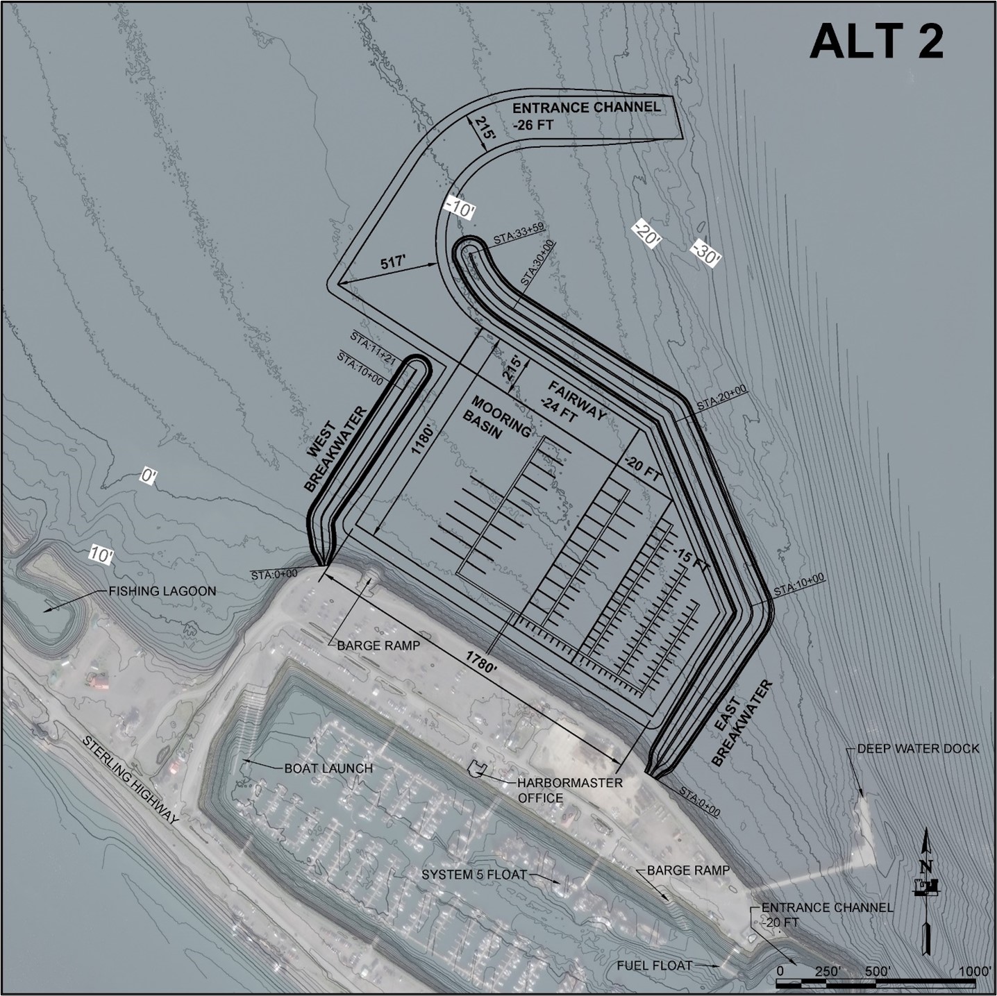
Alternative 2 is the USACE project team’s recommended Tentatively Selected Plan (TSP).
At their April 13, 2026 regular meeting, Homer City Council passed Resolution 26-024 concurring with the USACE selection and endorsing Alternative 2 as the Tentatively Selected Plan. Visit City Council Regular Meeting City of Homer Alaska Official Website for meeting information.
The USACE is expected to release the Draft Feasibility Report on May 22, 2026. This will start a 30-day opportunity for the public and agencies to review and comment on the plan.
Alternative 2 Details
- Mooring Basin: 37 acres
- Dredging: 1,312,000 cy
- Breakwater Rock: 500,000 cy
- Breakwater alignments remain the same after geotechnical study results; breakwater cross-section widened from 15’-20’
- The parking area does not appear in the current diagram because the USACE considers it a Local Service Facility — not required for safe navigation and moorage and therefore outside the federal project scope. The City fully recognizes the importance of adequate parking to harbor users and the community and is committed to addressing this as a key consideration in future design phases.
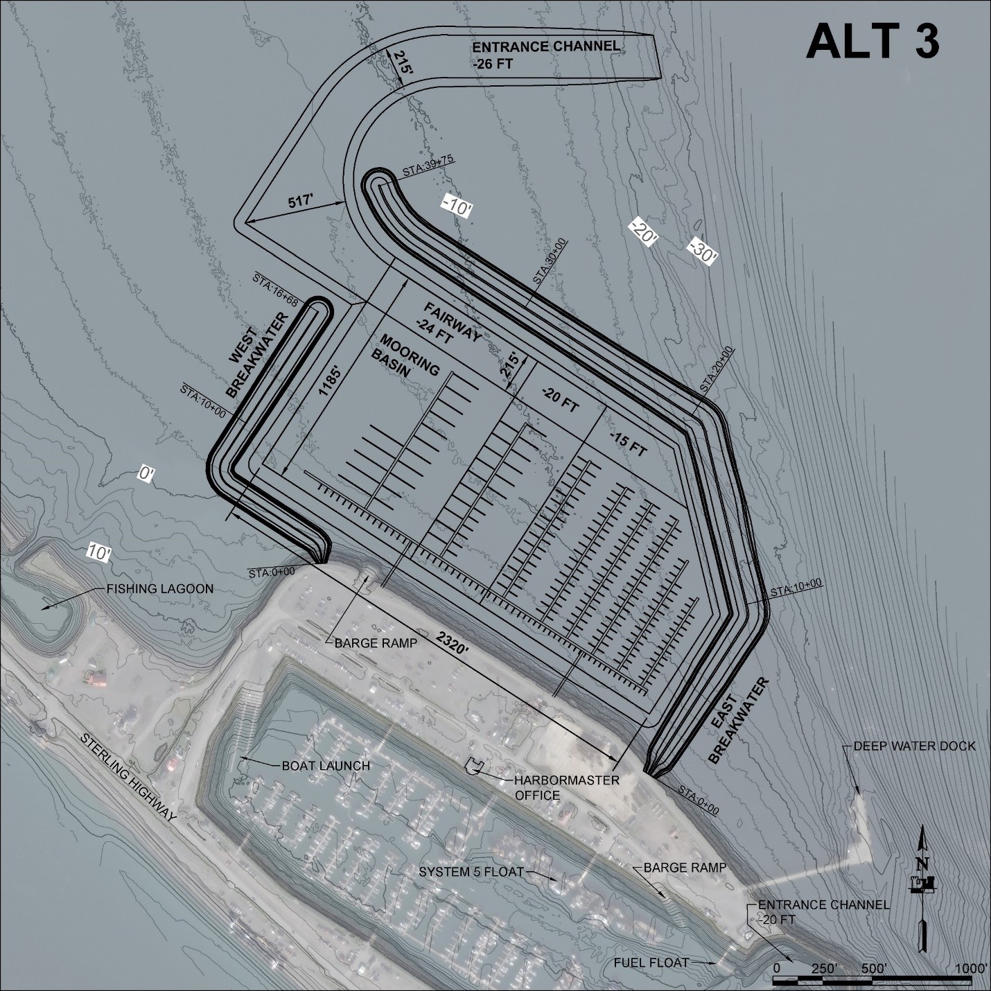
USACE Design Alternatives
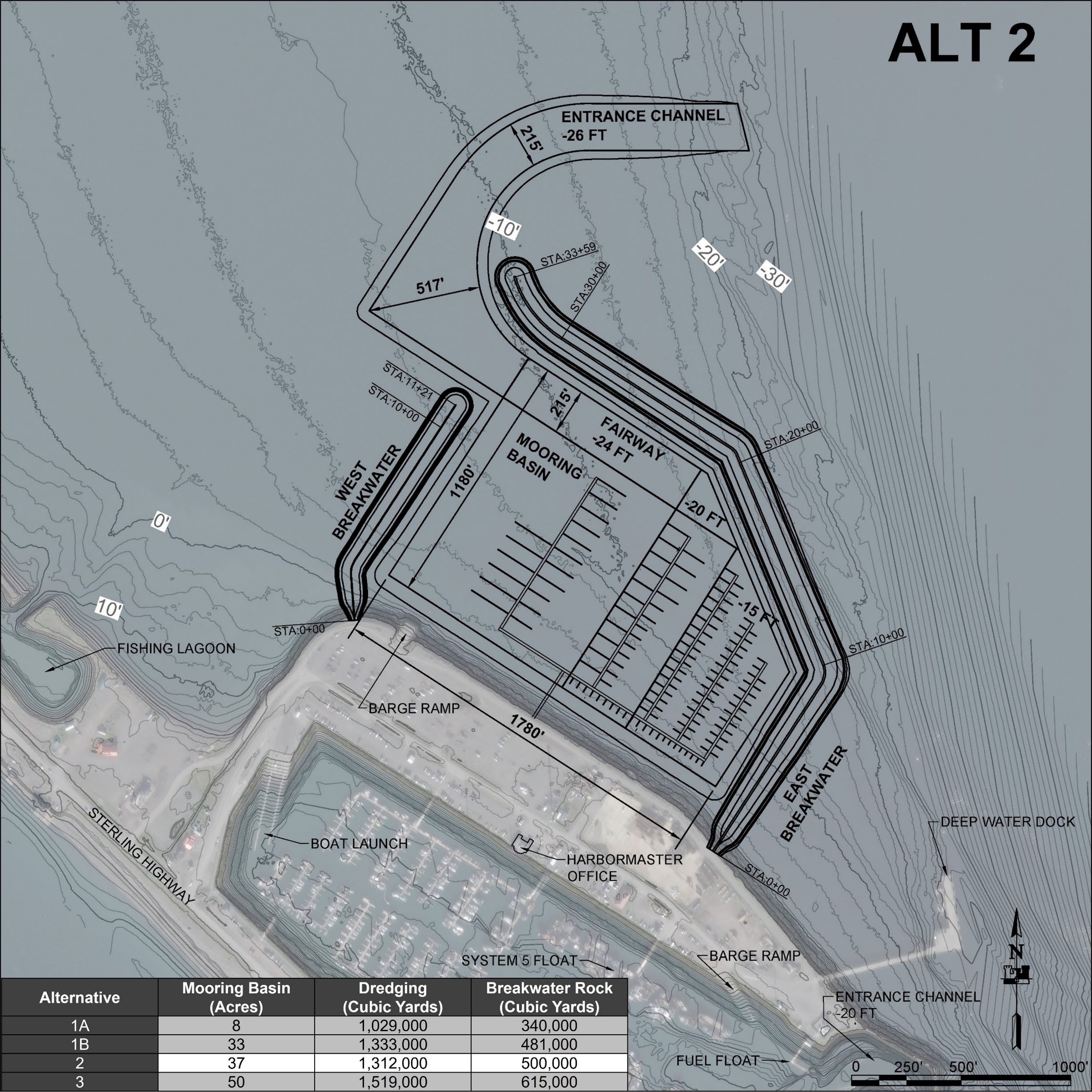
- Click image above to enlarge
To reach TSP, the USACE applied the feasibility analysis to four final concept designs, each representing a distinct vision of the fleet to be served — varying in the scope of moorage demand addressed. Hydraulic and geotechnical assessments, environmental surveys, ecological modeling, transportation and vessel traffic data, and economic analysis informed the development and evaluation of each alternative. Engineering and design constraints, environmental considerations, and cost-effectiveness were weighed against the study’s navigational safety, operational, and community viability benefits.
Alternative 2 advances the core objectives of the study by directly addressing the navigational safety risks, overcrowding, and operational inefficiencies that define the current harbor’s limitations. Its selection reflects not only engineering and economic analysis, but the environmental assessments and ecological modeling that shaped each alternative from the outset and informed the final determination.
Homer Harbor has undergone four expansions since its original construction, and at least two major studies have been conducted since the last expansion was completed in 1985. Each expansion was quickly outgrown. By accommodating all currently waitlisted vessels, Alternative 2 represents a sustainable, long-term solution for the community and for federal investment.
Your feedback is helping to make this project a success!
Additional information may be found on the Documents and Resources Page:
- USACE Alternatives Concepts
- USACE Alternatives Concepts Dictionary of Maritime Terms
- September 2023 Draft Alternatives
We are committed to keeping you informed.
The USACE released the Draft Feasibility Report on May 22, 2026. This will start a 30-day opportunity for the public and agencies to review and comment on the plan. Visit https://www.poa.usace.army.mil/Media/News-Releases/Article/4499169/usace-seeks-public-comment-on-draft-homer-harbor-study/ to learn how to access the report and provide comments.
You are on our mobile alternatives site. The tables presented here is large and requires scrolling and is best viewed at 100% on a laptop, desktop or tablet.
You can reach out to the City of Homer HHE project team with questions at
Email:
info@homerharborexpansion.com
Phone:
(907) 268-2909
Address:
Homer Harbormaster Office
4311 Freight Dock Road
Homer, AK 99603
2025 Draft Alternatives
The Draft Alternatives shown below were presented at the March 15, 2025 Public Meeting.
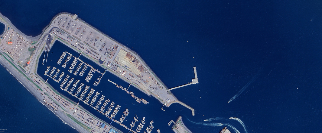
Alternative 0: No Build
Work throughout the study will compare the conditions of the current harbor against conditions created by an expanded harbor design to determine the value and feasibility of an expansion.
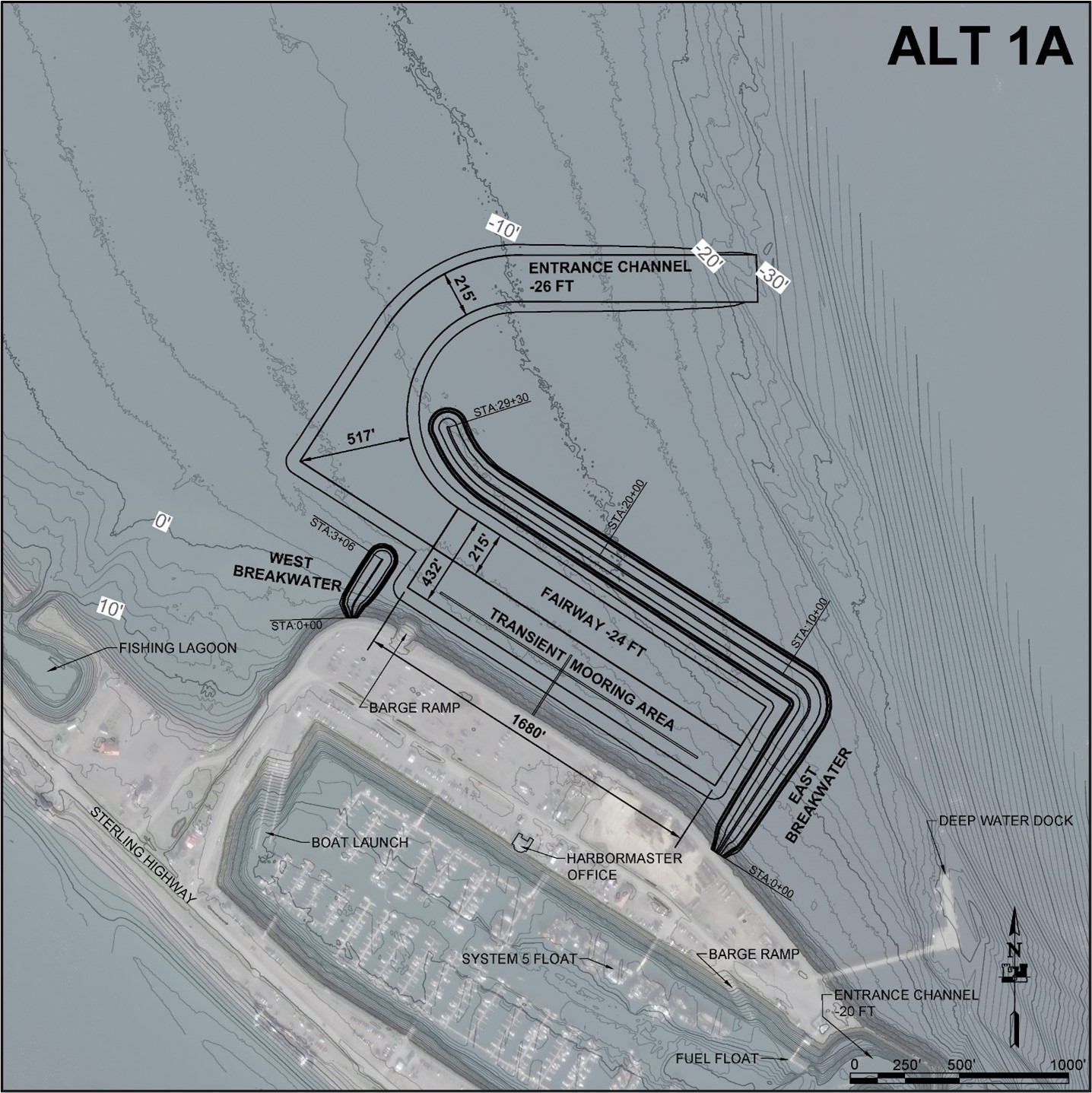
Alternative 1A: Immediate Needs
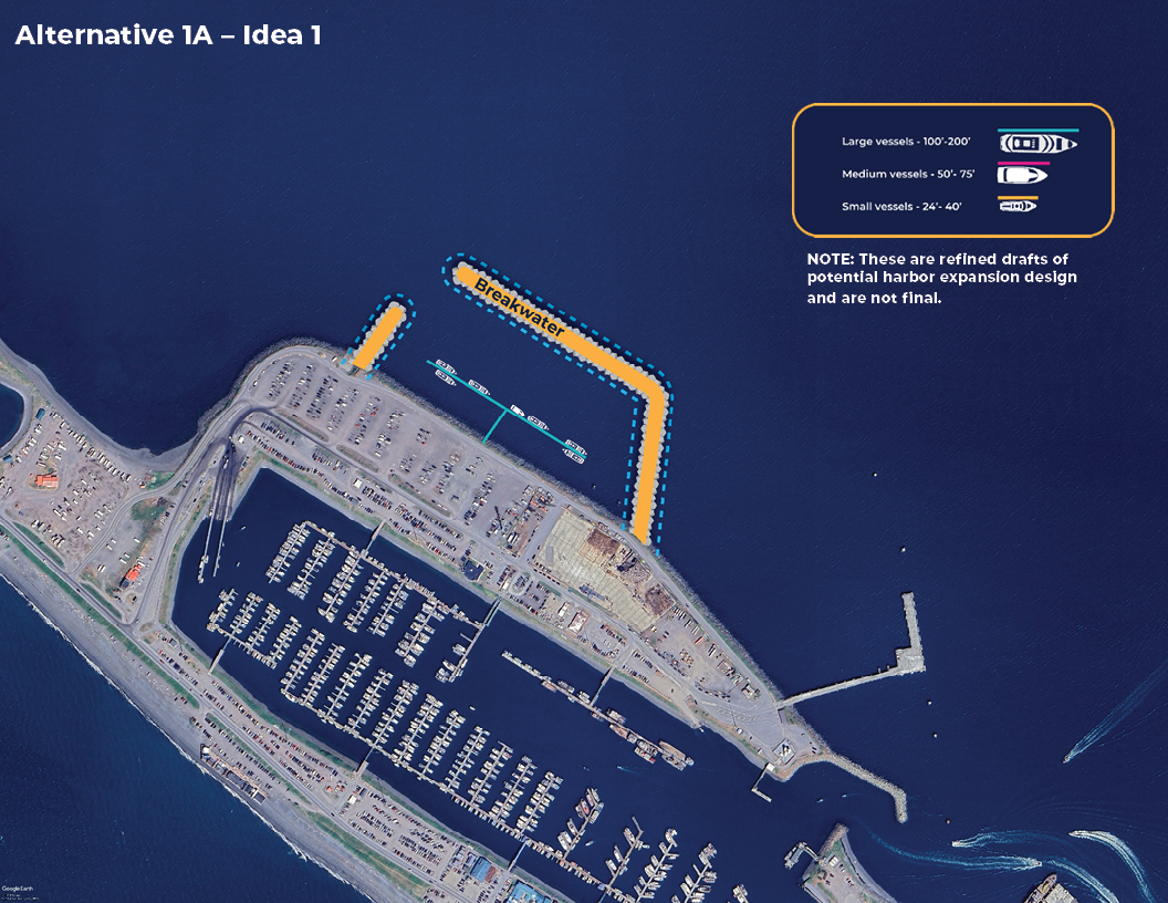
- Idea 1: Click image above to enlarge
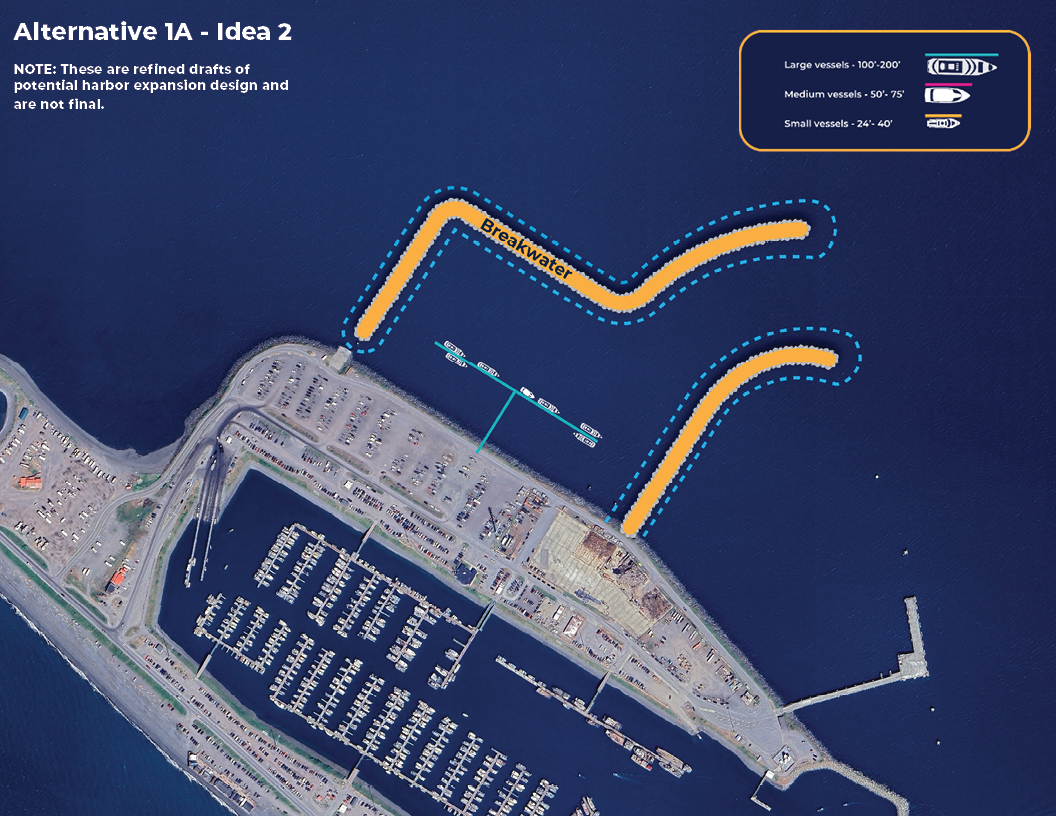
- Idea 2: Click image above to enlarge
A1A
Immediate Needs
- Includes a new exterior harbor
- Relocates vessels from Transient Float System 5 from the small boat harbor to the new exterior harbor
- Accommodates vessels that use the deep-water dock
- Provides additional small craft moorage in existing harbor
Reduces rafting for large vessels within the new harbor basin.
A waitlist remains for the harbor.
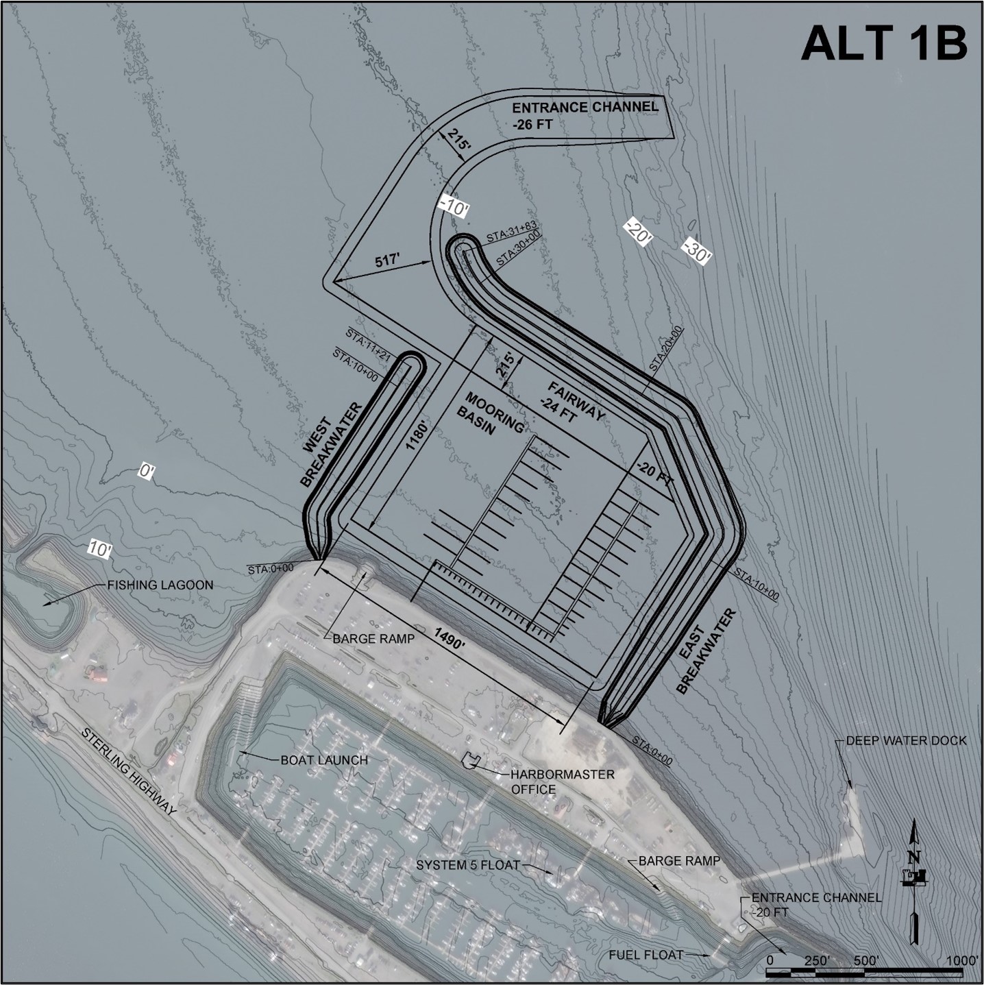
A1B
Immediate Needs+
Alternative 1B contains all Alternative 1A features plus:
- Provides large vessels with dedicated stalls in new harbor basin
- Eliminates rafting
- Provides opportunity for additional uplands for local services facilities such as a fuel dock or barge ramp
A waitlist remains for the harbor.
Alternative 1B: Immediate Needs+
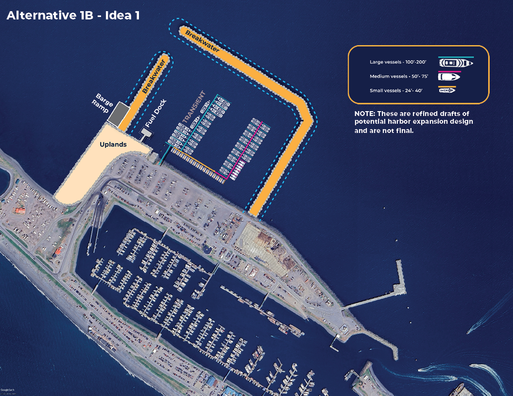
- Idea 1: Click image above to enlarge
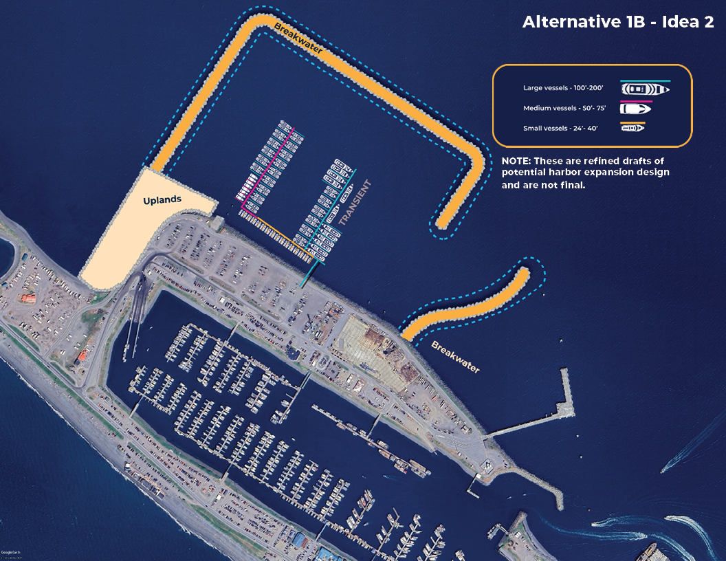
- Idea 2: Click image above to enlarge
Alternative 2: Current Needs
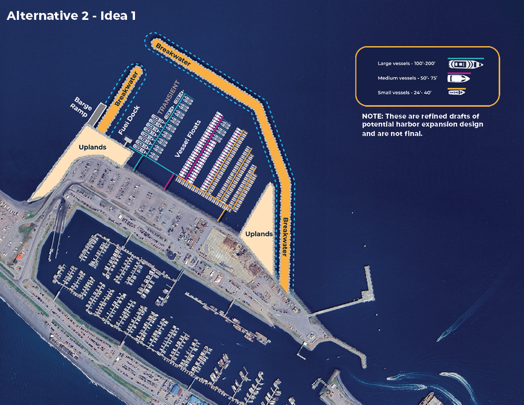
- Idea 1: Click image above to enlarge
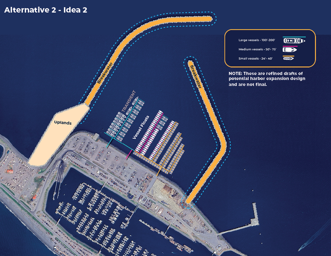
- Idea 2: Click image above to enlarge
A2
Current Needs
Alternative 2 contains all Alternative 1B features plus:
- Additional floats to accommodate current waitlist for moorage in the harbor
- Additional uplands for local services facilities.
Meets the existing harbor needs and demand.
A3
Modeled Growth
Alternative 3 features the largest footprint to meet current and likely future projected needs by:
- Containing all features from Alternative 2
- Adding extended uplands and floats
Accommodates modeled “likely” growth over the next 50 years.
Alternative 3: Modeled Growth
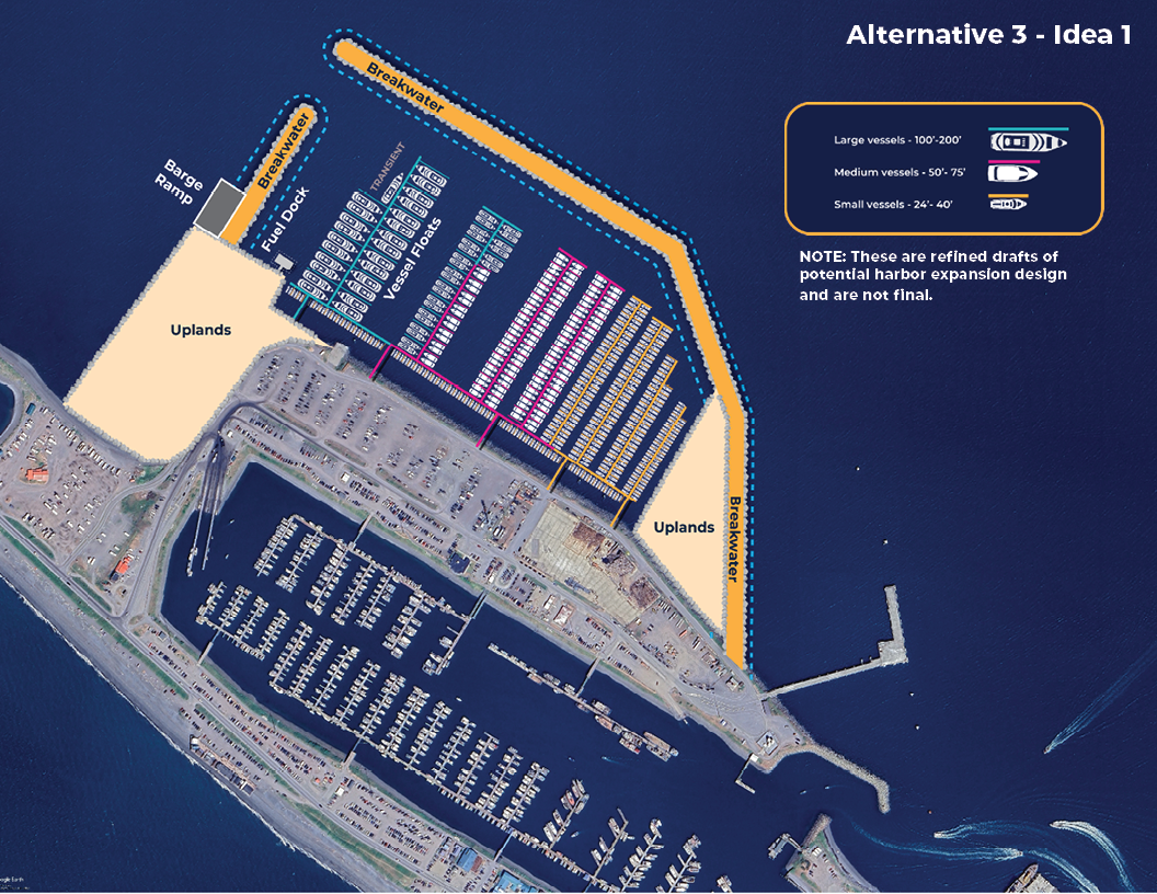
- Idea 1: Click image above to enlarge
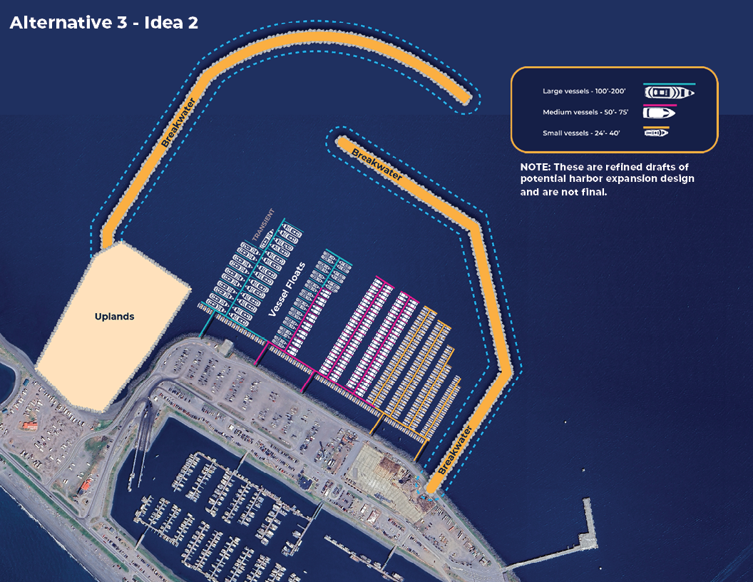
- Idea 2: Click image above to enlarge